

Cathedral Group Cartography Map
Shop this locally at MADE.
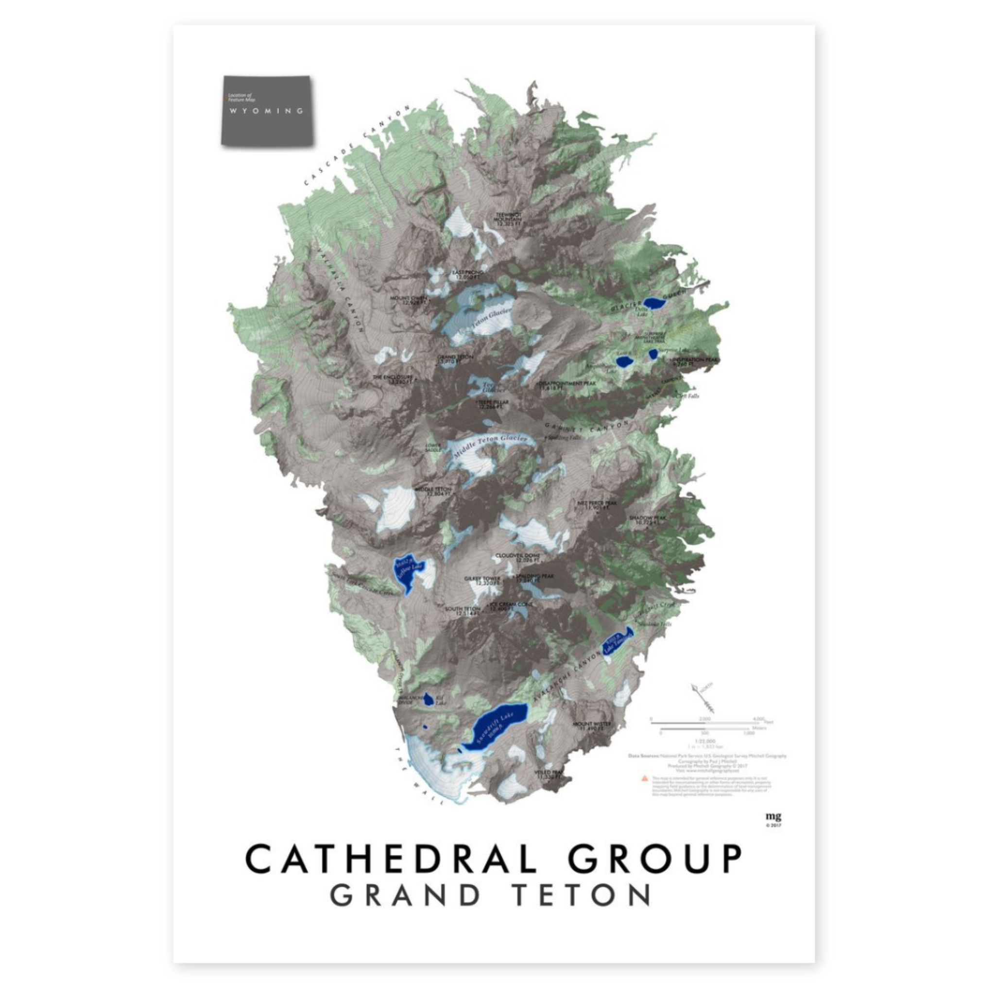
A focused take on the high peaks centered around the Grand, using the U.S. Geological Survey's 1-meter Lidar terrain model.
Map Ranges from Cascade Canyon and Teewinot Mountain in the north to Avalanche Canyon/Snowdrift Lake and Veiled Peak in the south. Map features glaciers/snowfields, lakes, vegetation patches, maintained NPS trails, and feature labels with elevation.
13x19in.
Cathedral Group Cartography Map
Sale price$ 25.00
Choose options
Cathedral Group Cartography Map
Sale price$ 25.00